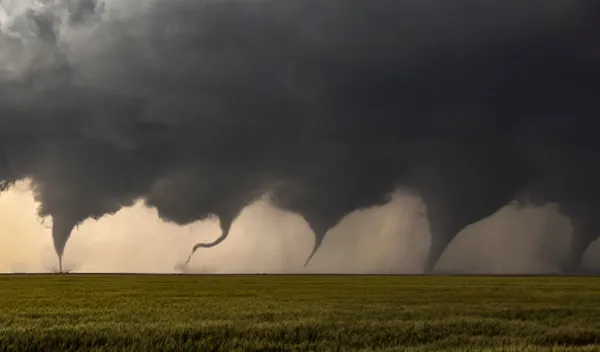
Tornado Near Floresville TX Today: Tornado Warning Issued as Dangerous Storm Moves Northeast Across Wilson County
A tornado warning was issued near Floresville, TX, as a rotating severe thunderstorm moved northeast through Wilson County. Get the latest updates on the storm track, confirmed tornado activity, emergency response, safety tips, and what residents need to know.
Tornado Near Floresville TX: Tornado Warning Issued as Severe Storm Tracks Northeast
Residents across Floresville, Texas, and surrounding parts of Wilson County were urged to take immediate shelter after the National Weather Service (NWS) issued a tornado warning for a dangerous thunderstorm capable of producing a tornado. The storm, which developed near Elmendorf, rapidly intensified while moving northeast, prompting emergency officials to activate warning systems as severe weather swept across South Texas.
The tornado warning came during an active day of severe weather that produced multiple warnings across the San Antonio metropolitan area, with meteorologists closely monitoring rotating storm cells capable of producing tornadoes, damaging straight-line winds, large hail, and torrential rainfall.
Tornado Warning Near Floresville: What Happened?
According to the National Weather Service, Doppler radar detected strong rotation within a severe thunderstorm located approximately 10 miles northwest of Floresville near Elmendorf. The storm continued moving northeast at a steady pace, placing communities across Wilson County directly in its projected path.
Meteorologists warned that atmospheric conditions were highly favorable for tornado development due to significant wind shear, abundant Gulf moisture, and unstable air across South Central Texas. Residents were advised to seek shelter immediately rather than waiting for visual confirmation of a tornado.
Emergency alerts were distributed across the affected communities as officials emphasized the life-threatening nature of the storm.
Radar Shows Strong Rotation
Weather radar played a critical role in tracking the storm as forecasters observed persistent rotation within the thunderstorm. While not every rotating storm produces a tornado, radar signatures indicated conditions capable of supporting tornado formation.
The severe thunderstorm was embedded within a larger weather system affecting numerous counties around San Antonio. Meteorologists monitored the storm continuously as it advanced toward populated areas, issuing updated warnings as necessary.
The combination of:
- Strong atmospheric instability
- Enhanced low-level wind shear
- Deep Gulf moisture
- Intensifying thunderstorm development
created an environment favorable for severe weather across South Texas.
Confirmed Tornadoes Elsewhere in South Texas
The Floresville tornado warning followed confirmed tornado activity elsewhere in the region.
Earlier in the day, the National Weather Service confirmed that a tornado touched down near the Interstate 10 and Loop 1604 corridor in northwest San Antonio, affecting areas near The Rim and The Dominion.
Another tornado warning was later issued near Calaveras Lake in eastern Bexar County as additional rotating storms developed.
The multiple tornado warnings highlighted the widespread impact of the severe weather outbreak moving across South Central Texas and reinforced the importance of taking every tornado warning seriously.
Wilson County Emergency Response
Emergency management officials throughout Wilson County responded quickly after the tornado warning was issued.
Authorities activated local warning systems and encouraged residents to:
- Move to an interior room on the lowest floor.
- Stay away from windows.
- Avoid traveling until the storm passed.
- Monitor official weather updates.
- Prepare for rapidly changing weather conditions.
Emergency personnel also monitored reports of storm damage while remaining prepared for potential rescue operations should tornado damage occur.
Floresville’s History with Tornadoes
Floresville has experienced damaging tornadoes before, making residents particularly aware of severe weather risks.
One of the area’s most significant tornadoes was an EF-2 tornado that caused extensive damage to Floresville High School, numerous homes, and surrounding infrastructure.
That history has encouraged local emergency officials to maintain strong preparedness plans whenever tornado warnings are issued.
Severe Weather Across South Texas
The tornado threat near Floresville formed as part of a larger severe weather system stretching across much of South Central Texas.
Meteorologists warned that the storm system could continue producing:
- Tornadoes
- Damaging wind gusts exceeding 70 mph
- Large hail
- Frequent lightning
- Heavy rainfall
- Flash flooding in low-lying areas
Residents throughout the region were encouraged to remain alert as additional severe thunderstorms developed throughout the afternoon and evening.
Tornado Safety Remains Critical
Officials continue reminding residents that tornadoes can develop with very little warning.
If a tornado warning is issued:
- Immediately move to the lowest floor of a sturdy building.
- Shelter in a small interior room or hallway.
- Stay away from windows and exterior walls.
- Cover your head and neck with blankets, pillows, or a mattress if possible.
- Avoid sheltering beneath highway overpasses.
- Leave mobile homes immediately and seek stronger shelter if it is safe to do so.
Having multiple methods of receiving weather alerts—including NOAA Weather Radio, emergency smartphone alerts, and trusted local media—can provide valuable minutes of additional warning.
Weather Outlook
Forecasters continue monitoring additional thunderstorms capable of producing severe weather across South Texas. While individual storms may weaken or strengthen rapidly, atmospheric conditions remain supportive of severe thunderstorms capable of producing tornadoes.
Residents across Floresville, Wilson County, and neighboring communities are encouraged to stay informed through official National Weather Service forecasts and heed all warnings issued by local emergency management agencies.
Frequently Asked Questions
Was there a tornado near Floresville, Texas?
A tornado warning was issued after radar detected a rotating severe thunderstorm near Elmendorf moving toward Floresville. The warning indicated that conditions were favorable for tornado development.
Why was the tornado warning issued?
The National Weather Service observed strong rotation within a severe thunderstorm using Doppler radar, indicating the storm was capable of producing a tornado.
Were tornadoes confirmed elsewhere in South Texas?
Yes. Earlier in the day, the National Weather Service confirmed a tornado near Interstate 10 and Loop 1604 in San Antonio, and additional tornado warnings were issued across Bexar County.
What areas were affected?
The warning primarily affected Floresville, Elmendorf, Wilson County, and portions of South Central Texas as the storm tracked northeast.
What should residents do during a tornado warning?
Residents should immediately move to the lowest level of a sturdy building, stay away from windows, monitor official weather updates, and remain sheltered until the warning expires.
Is additional severe weather expected?
Forecasters indicated that the broader storm system could continue producing severe thunderstorms capable of generating damaging winds, hail, heavy rainfall, and isolated tornadoes across portions of South Texas.